

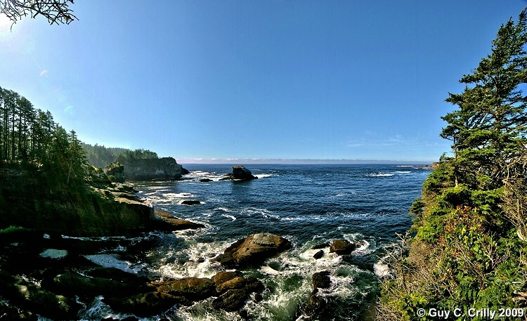
Cape Flattery Panorama Looking West
Here’s a five (5) shot panorama taken at Cape Flattery (the most northwestern point of the contiguous United States) looking west out over the Pacific Ocean. Taken after hiking about 7/10 of a mile down the Cape Flattery Trail (Green Trails map # 98S). As an aside, this trail is on the Makah Indian Reservation, and to park at the trailhead, one needs to purchase a Makah Tribe Recreational Use Permit while in Neah Bay, Washington, which in 2009 was only $10.00. Photographed with a vertically handheld DSLR (digital single lens reflex) camera set at ISO 100 and f/8 using a wide-angle zoom lens (12 to 24). Entered into the “Nature & Landscapes” category and shared with the BetterPhoto Club: “Photographing the Northwest -- Hiking Club.”
GPS: Approximate location, latitude 48° 23' 5.13" N, longitude 124° 43' 36.16" W.
Keywords: Panorama, Trees, Nature, Landscape, Makah Indian Reservation, USA, Ocean, and Water.
Uploaded on October 05, 2009