

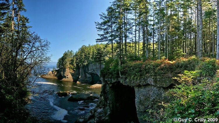
Cape Flattery Panorama Looking North
Here’s a six (6) shot panorama taken at Cape Flattery (the most northwestern point of the contiguous United States) looking north, in the distance one can see Vancouver Island, British Columbia, Canada, also to the bottom right one can see sea caves. Taken after hiking about 7/10 of a mile down the Cape Flattery Trail (Green Trails map # 98S). As an aside, this trail is on the Makah Indian Reservation, and to park at the trailhead, one needs to purchase a Makah Tribe Recreational Use Permit while in Neah Bay, Washington, which in 2009 was only $10.00. Photographed with a vertically handheld DSLR (digital single lens reflex) camera set at ISO 100 and f/8 using a wide-angle zoom lens (12 to 24). Entered into the “Nature & Landscapes” category and shared with the BetterPhoto Club: “Photographing the Northwest -- Hiking Club.”
GPS: Approximate location, latitude 48° 23' 7.49" N, longitude 124° 43' 31.68" W.
Keywords: Panorama, Trees, Nature, Landscape, Makah
Uploaded on October 02, 2009