
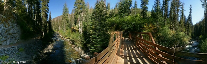
Entiat River Panorama
This is a 180-degree panorama taken on the trail (#1404) to Myrtle Lake where it crosses the Entiat River (Washington). Photographed with a vertically handheld DSLR (digital single lens reflex) camera set at ISO 400 and f/8 using a wide-angle zoom lens (12 to 24). To bring out the shadow detail the LDR (Low Dynamic Range) image was converted to a HDR (High Dynamic Range) image. Entered into the “Nature & Landscapes” category and shared with the BetterPhoto Club: “Photographing the Northwest -- Hiking Club.”
GPS: Approximate location, latitude 48° 03' 32.69" N, longitude 120° 41' 57.94" W.
Uploaded on January 12, 2009